फाइल:Sikkim locator map.svg

पूर्वावलोकन PNG क आकार SVG फाइल: ४२४ × ६०० चित्राणु दोसर resolutions: १७० × २४० चित्राणु | ३३९ × ४८० चित्राणु | ५४३ × ७६८ चित्राणु | ७२४ × १,०२४ चित्राणु | १,४४८ × २,०४८ चित्राणु | १,५९५ × २,२५६ चित्राणु।
पूर्ण आनन्तर्य (एसभिजी फाइल, मामूली रूपमे १,५९५ × २,२५६ चित्रकण, फाइलक आकार: २४४ KB)
| ई फाइल विकिमिडिया कमन्ससँ अछि। कमन्सकs विवरण पृष्ठसँ जानकारी एतए नीचाँ देखाएल गेल अछि। कमन्स एक फ्रि लाइसेन्स मिडिया फाइल परियोजना छि। अपने मद्ददतकs सकए छि। |
| शीर्षक |
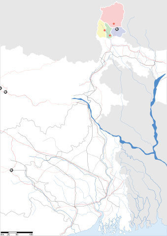
Sikkim locator map |
||
| Description |
Map of w:Sikkim with road and rail lines. Equirectangular projection. Geographic limits of the map: top=28.15, bottom=21.48, left=84.99, right=90.15. |
||
| दिनाङ्क | |||
| स्रोत |
अपन काम |
||
| रचियता |
|
||
| अनुमति (ई फाइलक पुनः उपयोग) |
मैं, इस कार्य का/की कॉपीराइट धारक, इसे निम्न लाइसेंस के अंतर्गत प्रकाशित करता/करती हूँ: ई फाइल लाइसेन्सड अछि एहि अन्तर्गत क्रिएटिभ कमन्स एट्रिब्युसन-सेयर अलाइक ३.० अनपोर्टेड लाईसेन्स ।
|
||
| Geotemporal data | |||
| Date depicted | second half of 20 century आर 21 century | ||
| Georeferencing | If inappropriate please set warp_status = skip to hide. | ||
| Archival data | |||
| नोट्स | Part of WikiProject India Maps | ||
फाइल इतिहास
तखनका तिथि/ समए पर क्लिक करी जखनका फाइल देखबाक अछि
| तिथि/ समए | लघुचित्र | बीमसभ | प्रयोक्ता | समीक्षा | |
|---|---|---|---|---|---|
| अखनका | १५:४३, १२ मई २००७ | | १,५९५ × २,२५६ (२४४ KB) | Planemad | border fix |
| ०१:०५, ८ मई २००७ |  | १,५९५ × २,२५६ (२५२ KB) | Planemad | border | |
| ००:५९, ८ मई २००७ |  | १,५९५ × २,२५६ (२४५ KB) | Planemad | {{WikiProject_India_Maps |Title=Gujarat locator map.svg locator map |Description=Map of w:Gujarat locator map.svg with road and rail lines. |Source= |Date=May 2007 |Author=w:user:Planemad }} Category:WikiProject India State Maps |
फाइलक उपयोग
ई पृष्ठमे ई फाइलक लिङ्क अछि:
विश्वव्यापी फाइल उपयोग
ई फाइल कऽ उपयोग निम्न दोसर विकिसभमे अछि:
- as.wikipedia.org कऽ उपयोग पर
- be.wikipedia.org कऽ उपयोग पर
- de.wikipedia.org कऽ उपयोग पर
- dty.wikipedia.org कऽ उपयोग पर
- en.wikipedia.org कऽ उपयोग पर
- es.wikipedia.org कऽ उपयोग पर
- fa.wikipedia.org कऽ उपयोग पर
- gu.wikipedia.org कऽ उपयोग पर
- hi.wikipedia.org कऽ उपयोग पर
- lv.wikipedia.org कऽ उपयोग पर
- ml.wikipedia.org कऽ उपयोग पर
- ms.wikipedia.org कऽ उपयोग पर
- or.wikipedia.org कऽ उपयोग पर
- pam.wikipedia.org कऽ उपयोग पर
- pnb.wikipedia.org कऽ उपयोग पर
- sw.wikipedia.org कऽ उपयोग पर
- ta.wikipedia.org कऽ उपयोग पर
- uk.wikipedia.org कऽ उपयोग पर
- vi.wikipedia.org कऽ उपयोग पर
- yo.wikipedia.org कऽ उपयोग पर