फाइल:La2-demis-ladoga.png
ऐ पूर्वदृश्यक आकार: ४८८ × ६०० चित्राणु. दोसर resolutions: १९५ × २४० चित्राणु | ६३८ × ७८४ चित्राणु।
पूर्ण आनन्तर्य (६३८ × ७८४ चित्राणु, फाइल आकार: ७१ KB, माइम प्रकार: image/png)
| ई फाइल विकिमिडिया कमन्ससँ अछि। कमन्सकs विवरण पृष्ठसँ जानकारी एतए नीचाँ देखाएल गेल अछि। कमन्स एक फ्रि लाइसेन्स मिडिया फाइल परियोजना छि। अपने मद्ददतकs सकए छि। |
सङ्क्षेप
| जानकारी |
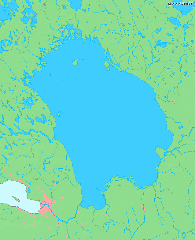
English: Lake Ladoga, in Russia.
Bounding box West 29.4°, South 59.6°, East 33.4°, North 62.0°. Center at 60°48′00″N 31°24′00″E / 60.80000°N 31.40000°E. |
| दिनाङ्क | |
| स्रोत | Demis map server |
| लेखक | Demis map server |
This image is in the public domain because it came from the site https://www.demis.nl/products/web-map-server/examples/ and was released by the copyright holder. Permission is granted to copy, distribute and/or modify this map since it is based on free of copyright images from: www.demis.nl. See also approval email on de.wp and its clarification.
|
| This work has been released into the public domain by its copyright holder, www.demis.nl. This applies worldwide. कुछ देशों में यह कानूनी तौर पर नहीं हो सकता है; ऐसा हो तो: www.demis.nl सभी को इस कार्य का इस्तेमाल किसी भी उद्देश्य से, बिना किसी बाधाओं के इन शर्तों के कानून द्वारा अनिवार्य किए तक करने की अनुमति देता/देती हैं।
|
derivative works
Derivative works of this file: Ладогӕйы цад.png
फाइल इतिहास
तखनका तिथि/ समए पर क्लिक करी जखनका फाइल देखबाक अछि
| तिथि/ समए | लघुचित्र | बीमसभ | प्रयोक्ता | समीक्षा | |
|---|---|---|---|---|---|
| अखनका | १६:५४, ३० अगस्त २००५ | | ६३८ × ७८४ (७१ KB) | LA2 | Lake Ladoga in Russia. {{demis-pd}} category:Maps of Russia |
फाइलक उपयोग
ई पृष्ठमे ई फाइलक लिङ्क अछि:
विश्वव्यापी फाइल उपयोग
ई फाइल कऽ उपयोग निम्न दोसर विकिसभमे अछि:
- bg.wikipedia.org कऽ उपयोग पर
- bn.wikipedia.org कऽ उपयोग पर
- cs.wikipedia.org कऽ उपयोग पर
- cu.wikipedia.org कऽ उपयोग पर
- en.wikipedia.org कऽ उपयोग पर
- es.wikipedia.org कऽ उपयोग पर
- et.wikipedia.org कऽ उपयोग पर
- fa.wikipedia.org कऽ उपयोग पर
- fi.wikipedia.org कऽ उपयोग पर
- fr.wikipedia.org कऽ उपयोग पर
- gl.wikipedia.org कऽ उपयोग पर
- hr.wikipedia.org कऽ उपयोग पर
- id.wikipedia.org कऽ उपयोग पर
- incubator.wikimedia.org कऽ उपयोग पर
- is.wikipedia.org कऽ उपयोग पर
- it.wikibooks.org कऽ उपयोग पर
- ja.wikipedia.org कऽ उपयोग पर
- ko.wikipedia.org कऽ उपयोग पर
- la.wikipedia.org कऽ उपयोग पर
- lv.wikipedia.org कऽ उपयोग पर
- ms.wikipedia.org कऽ उपयोग पर
- ne.wikipedia.org कऽ उपयोग पर
- nl.wikipedia.org कऽ उपयोग पर
- nn.wikipedia.org कऽ उपयोग पर
- no.wikipedia.org कऽ उपयोग पर
- pa.wikipedia.org कऽ उपयोग पर
- pl.wiktionary.org कऽ उपयोग पर
- pt.wikipedia.org कऽ उपयोग पर
- ro.wikipedia.org कऽ उपयोग पर
- sh.wikipedia.org कऽ उपयोग पर
- sk.wikipedia.org कऽ उपयोग पर
- sl.wikipedia.org कऽ उपयोग पर
- sr.wikipedia.org कऽ उपयोग पर
- sw.wikipedia.org कऽ उपयोग पर
- th.wikipedia.org कऽ उपयोग पर
- tr.wikipedia.org कऽ उपयोग पर
- uk.wikipedia.org कऽ उपयोग पर
- uz.wikipedia.org कऽ उपयोग पर
- vep.wikipedia.org कऽ उपयोग पर
ई फाइलक विश्वव्यापी उपयोगक अधिक जानकारी देखी।